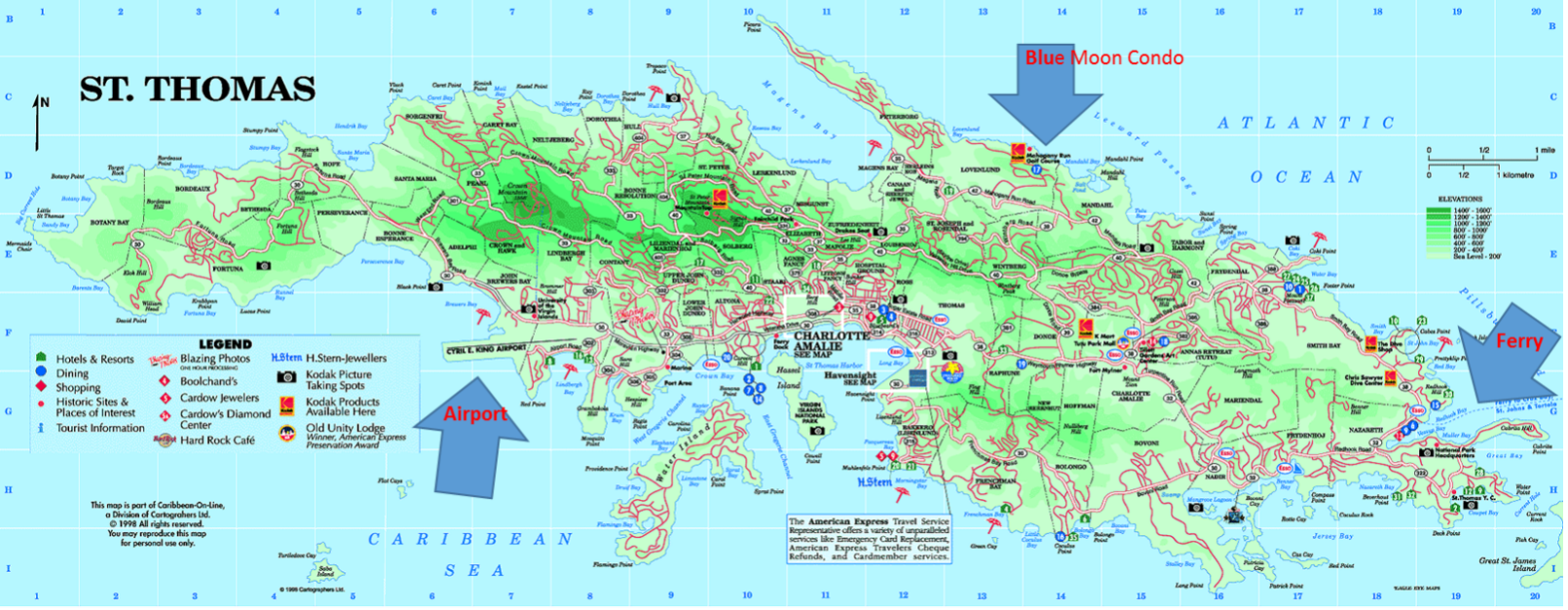
Directions to the Blue Moon!
Laura & Tom Gorman
651-276-3076 (LKG)
651-336-8974 (TG)
1. Come out of the airport and Turn Right on Route 30. This will take you through town ... just follow this road until you see lots of shops (town) on the left hand side and the waterfront on the right hand side (approx. 3 miles from the airport).
2. Go through town … past all of the BLUE TENTS (an outdoor market … on the left) … and continue on … past the VIRGIN ISLAND LEGISLATURE buildings on right. You'll be turning left at the very next stop light … Route 35 - "Hospital Gade" (pronounced Hospital GADA). There is a large government office building on the corner where you turn and a large parking lot on the left with generally lots of police cars.
3. Turn Left on Route 35 (Hospital Gade). The sign is very hard to see until you turn the corner, but there is a big yellow government building on the corner as you turn … and again … there is a large parking lot on the left).
4. Follow Route 35 up 3 blocks where the road "T's". Turn Left and continue up and over the hill (this is a fairly windy road) toward MAGEN'S BAY (follow the signs to Magen's Bay).
5. Turn Right on Route 42 (toward Red Hook). Follow Route 42 (approx. 3 miles) until you see the sign for MAHOGANY RUN GOLF COURSE on the Left.
6. Stop at the Guard Gate and pick up your parking pass. Then …
7. Take Mahogany Run Golf Course Drive (Mahogany Run North) up the hill.
8. Go past the Closed Golf Course (on your left) continuing up the hill and around.
9. At the top of the hill, turn left on Barbados Circle ... proceed straight to the first White Building on the right. This is Building 17 and we are the middle unit. Park against the rock wall leaving enough room for cars to pass.

